
The new map of potential closures shows the blocked water access to Ukraine.
Andriy Klymenko of Black Sea News, posted it on his Facebook page.
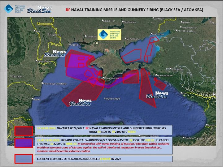
He drew attention to the fact that the new version of the map contains more closures in the areas of the Black and Azov Seas. Map legend:
– purple color indicates a new (!) closure that started on February 11 (and it is planned to last for a whole monthuntil March 11) . You can see a large sea area that starts west of Crimea and ends near the Kerch Peninsula. The yet another Russian Navy drills are now being held there, for the sake of which 6 warships allegedly came there recently, coming from Russian naval base in Syria
– burgubdy show closure zones previously announced by Russia for military exercises starting from February 13 to February 19
– in blue – closures announced earlier in 2022
We continue to monitor Russian troops’ movement on Ukraine’s border. Should you have any information or evidence of Russian troops or equipment movement, or any other information you want to share with us, please send it to us via email [email protected] or text us on social media.